
Fresno ZIP Code Coverage
Fresno's practical delivery ZIPs cover a wide urban and Fresno County edge geography. The areas below are orientation notes drawn from USPS and local Fresno mapping sources, not legal boundaries. A ZIP code directory can tell a researcher where to start, but the individual address must still be checked. Post-office labels are included only where the researched source names a facility. Otherwise, “street delivery geography” avoids inventing a current station assignment.
| ZIP | Areas Covered | Post Office | Notes |
|---|---|---|---|
| 93701 | Central and east-central Fresno, including the Olive and Clinton core | Clinter station, 2601 E Olive Avenue | Street-delivery area |
| 93702 | Southeast-central Fresno east of downtown | USPS street delivery geography | Neighborhood labels cross postal lines |
| 93703 | East-central Fresno and airport-west area | USPS street delivery geography | Verify each address |
| 93704 | North-central Fresno and Fresno High or Old Fig vicinity | USPS street delivery geography | Not a Fresno city-limit line |
| 93705 | West-central Fresno | USPS street delivery geography | Street-delivery area |
| 93706 | Southwest and south Fresno with a broad rural edge | Fresno Post Office, 1900 E Street | Mailing geography extends beyond the dense core |
| 93710 | North-central and northeast Fresno near Fresno State | USPS street delivery geography | Campus-related addresses may use special codes |
| 93711 | Northwest Fresno | USPS street delivery geography | Check Fresno city status in GIS |
| 93720 | North and northeast Fresno, including Woodward Park | Woodward Park, 755 E Nees Avenue | Fresno and Clovis boundary context matters |
| 93721 | Downtown and civic center | Civic Center Fresno, 855 M Street Suite 190 | Central civic delivery geography |
| 93722 | West and northwest Fresno, including Highway City vicinity | USPS street delivery geography | Reaches Fresno city-edge and Fresno County context |
| 93723 | Far west and southwest growth area | USPS street delivery geography | Fresno city-limit mismatch is possible |
| 93725 | South and southeast Fresno with the Malaga-area edge | USPS street delivery geography | Postal Fresno can extend outside Fresno city |
| 93726 | Central and north-central Fresno | USPS street delivery geography | Street-delivery area |
| 93727 | East and southeast Fresno, Sunnyside, and eastern growth area | USPS street delivery geography | Check Fresno city, Clovis, or Fresno County status |
| 93728 | Tower District and west of downtown | Tower station, 824 E Fern Avenue | Neighborhood and ZIP do not match exactly |
| 93730 | Far northeast Fresno and Copper River area | USPS street delivery geography | Compare Fresno city limit and sphere of influence |
| 93737 | Newer east Fresno delivery geography | USPS street delivery geography | Confirm the address in USPS and GIS |
The practical list leaves out special and non-geographic codes on purpose. Fresno sorting products commonly show codes such as 93707-93709, 93712, 93714-93718, 93724, 93729, 93740-93741, 93744-93745, 93747, 93750, 93755, 93760-93761, 93764-93765, 93771-93779, 93784, 93786, 93790-93794, 93797, and 93799. Treat these as PO-box, firm, unique, or administrative handling codes until USPS identifies the current use. No current assignee is inferred here.
Fresno USPS ZIP Verification
The official USPS city-and-state lookup is the first check when a mailing ZIP is uncertain. It can return candidate delivery ZIPs for a Fresno place name, while a complete address check is the better test for one parcel. Save the returned ZIP, city line, and any station clue separately. A postal result does not establish whether a location lies inside the incorporated City of Fresno or which Fresno County office holds a record.
The USPS Fresno city and state ZIP lookup is the source shown in the postal image.
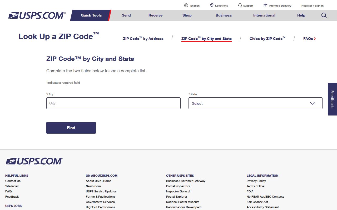
The USPS image shows the mailing lookup layer. Use it to confirm delivery geography, then hand the exact street address to Fresno GIS for parcel and jurisdiction fields.
Do not treat a post-office name as a neighborhood name. Clinter, Tower, Woodward Park, Civic Center Fresno, and the Fresno Post Office are facility or delivery clues supplied by the researched USPS material. They do not replace the address, APN, or Fresno city-limit check.
Fresno ZIP Code Search Path
A ZIP code directory narrows a geography but does not produce a free list of all people in that ZIP. The practical search path moves from mail validation to parcel identity, then to a record type that has a lawful access route.
- Run the USPS city-and-state or complete-address lookup and record the returned ZIP and postal city line.
- Check the same address in Fresno city GIS. Preserve the address parts, ZIP, APN, or Assessor Parcel Number, city flag, annexation date, tract, block, lot, and districts.
- Use the APN or exact address in the Fresno Assessor's value lookup. Treat the situs and any tax-mailing address as different fields.
- If ownership or transfer history is needed, carry the APN and owner name to the Fresno Recorder. The deed index is not a direct ZIP search.
- For street-level parcel work, continue with the Fresno street directory address workflow rather than assuming a ZIP result describes a block.
Fresno County refuses to sell a ZIP-only Situs Index extract, and the single-parcel Assessed Value Lookup uses address or APN modes rather than a ZIP browse. Fresno Elections can issue a Street Index or Walking List only through a restricted application and permitted purpose. No documented public portal returns every resident in 937xx for free.
Fresno GIS ZIP and APN Handoff
Fresno's address and parcel GIS supplies the bridge that a postal code cannot. Search or pan to the address, zoom until parcel geometry draws, select the target polygon, and record its APN, the Assessor Parcel Number. The map then supports a parcel-by-parcel review, but it does not expose assessor owner or tax-mailing fields. The APN must be carried to the Fresno County roll or Fresno Recorder.
The City of Fresno GIS and mapping page is the source shown in the parcel-map image.
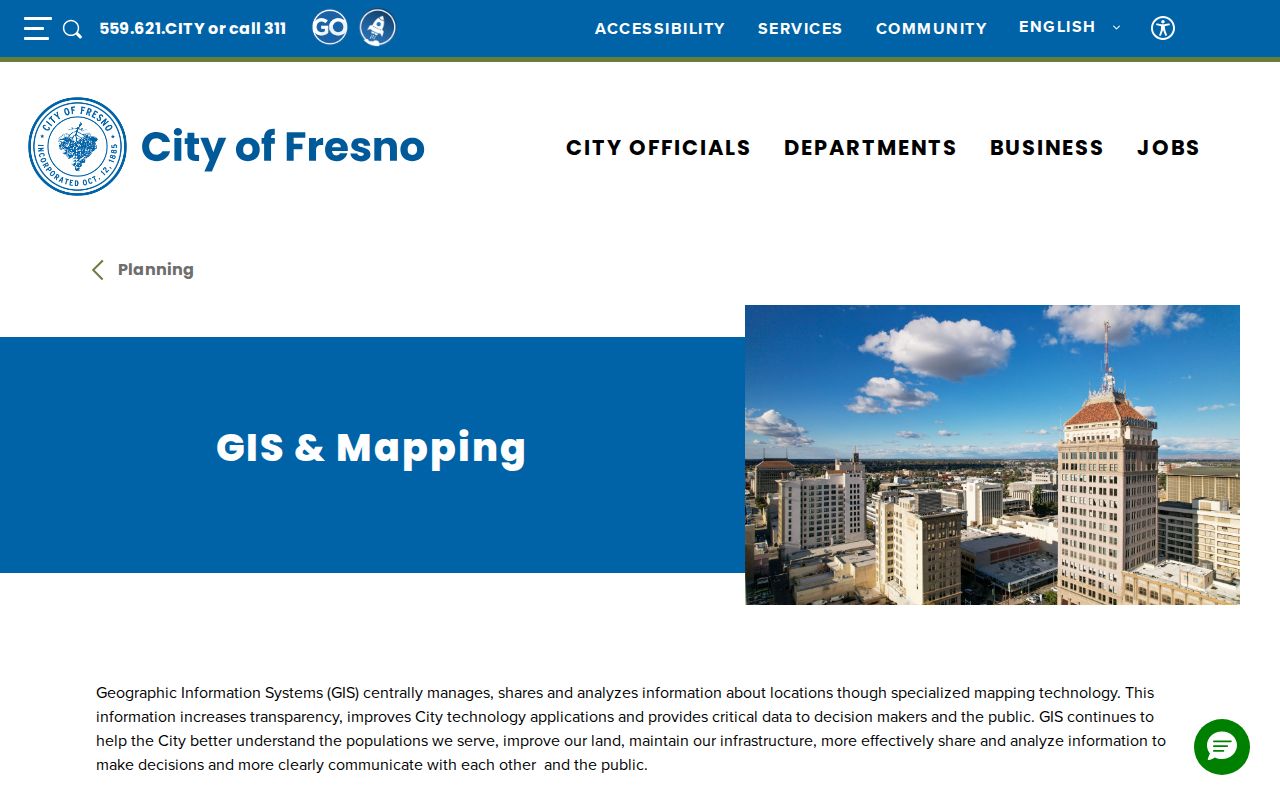
The GIS image illustrates why a ZIP result should become an APN handoff. The map can show geography and jurisdiction even when the public value screen does not show a name.
| ADDRESS | Search or display value for the civic address. |
|---|---|
| ADRNUM, ADRDIR, ADRNAME, ADRSUFF, ADRAPT | Parsed street number, direction, name, suffix, and apartment components. |
| ZIP | Postal field returned with the address feature. |
| APN | Parcel join key for the Assessor, tax search, and deed workflow. |
| INSIDE_CITY | City-status field that helps separate a Fresno postal address from incorporated jurisdiction. |
| ANNEX_DATE | Annexation clue for understanding when the parcel entered city geography. |
| TRACT, BLOCK, LOT and districts | Map and service context, including census, school, council, police, and planning fields. |
The Fresno City GIS service supports query and attachments but does not advertise a public radius or buffer search. A map walk is the dependable way to inspect nearby parcels. Its accuracy and timeliness disclaimer means a recorded map or deed controls when a legal result matters.
Fresno ZIP Code City Mismatch
ZIP boundaries and Fresno city limits were built for different systems. Addresses in 93706, 93722, 93723, 93725, 93727, and 93730 are especially likely to require a point-by-point check at the irregular edge. A last line that says Fresno can coexist with Fresno County jurisdiction. An annexation can change Fresno city service responsibility without changing the familiar postal label. Check INSIDE_CITY, ANNEX_DATE, council district, and sphere-of-influence fields for the exact parcel.
- ZIP code
- A five-digit USPS delivery-area identifier. It is a mail route, not a municipal boundary or household roll.
- Situs address
- The physical address attached to a taxable parcel, distinct from a tax-mailing address or postal city line.
- ZIP+4
- An added four-digit delivery segment that narrows routing beyond the five-digit ZIP.
- PO-box ZIP
- A code used mainly for post-office boxes or a handling group, not proof of a street parcel.
- Unique ZIP
- A code assigned to a specific firm, institution, or other dedicated delivery group when USPS uses one.
- Carrier route
- A delivery sequence inside postal operations; it is more specific than a ZIP but is not a public resident list.
Neighborhood names also resist one-to-one ZIP matching. Tower District, Chinatown, Sunnyside, Woodward Park, and Old Fig Garden have Fresno histories and boundaries that do not line up neatly with postal or municipal lines. Use the parcel point and official map layers before selecting the Fresno City Clerk, Fresno County, Fresno planning, Fresno court, or Fresno Elections custodian.
Fresno Postal Portal Limits
Different Fresno systems accept or return ZIP information in different ways. The important question is not whether a ZIP appears somewhere on a screen, but whether the portal can search by ZIP and what a result actually represents.
| Portal | ZIP behavior | What to do next |
|---|---|---|
| City address and parcel GIS | Returns ZIP with address, APN, city flag, annexation, census, and planning fields | Take the APN to the Assessor or Recorder |
| Fresno Assessed Value Lookup | Searches a single parcel by address or APN; no documented ZIP browse | Verify the exact situs first |
| Assessor Situs Index | Full Fresno County street-to-APN file, not a ZIP-only extract | Use the whole-file route only for a lawful purpose |
| Current ownership and mailing file | Full Fresno County owner and tax-mailing data, updated monthly | Compare owner, situs, and mailing address |
| Fresno voter Street Index | ZIP appears in the application and address fields, not as an open ZIP search | Use the signed, permitted-purpose application |
| Fresno County Recorder index | Searches party, date, document, and book or page keys rather than ZIP | Start with owner or legal description |
Fresno County's annual Situs Index costs $29.21 for the full file. The monthly Current Ownership Name and Mailing Address file is listed at $30.94 for text or CSV and $54.94 for PDF. Those products are not a promise of a free, filtered list. They also do not turn an owner or mailing address into proof of every person at a parcel.
Fresno Special Postal Codes
Special codes deserve a separate handling rule because a postal directory can make them look like neighborhoods. Codes in the 93707-93709, 93712, 93714-93718, 93724, 93729, 93740-93741, 93744-93745, 93747, 93750, 93755, 93760-93761, 93764-93765, 93771-93779, 93784, 93786, 93790-93794, 93797, and 93799 groups appear in official Fresno sorting products as PO-box, firm, unique, or administrative destinations. The public USPS lookup is address or session driven and does not provide one stable list of every present assignee.
Do not call one of these codes a Fresno neighborhood, assign it to an unnamed institution, or infer that it identifies a street household. Verify the current use through USPS city-and-state or address lookup. If a record gives only a special ZIP, ask for the street address, post-office box, entity name, or document number that can make the next search precise.
Note: A special ZIP is a routing clue; it needs an address or named custodian before it can support local Fresno record research.
Fresno Mailing Neighborhood Context
Population context helps explain why one ZIP can contain several kinds of Fresno records, but it does not turn a demographic estimate into a resident file. The 2020 Census counted 542,107 people in the City of Fresno. QuickFacts supplies additional Fresno city context, while parcel GIS separates Fresno city, Fresno County, census, planning, and service geography for a particular address.
The U.S. Census QuickFacts Fresno table is the source shown in the population and geography image.
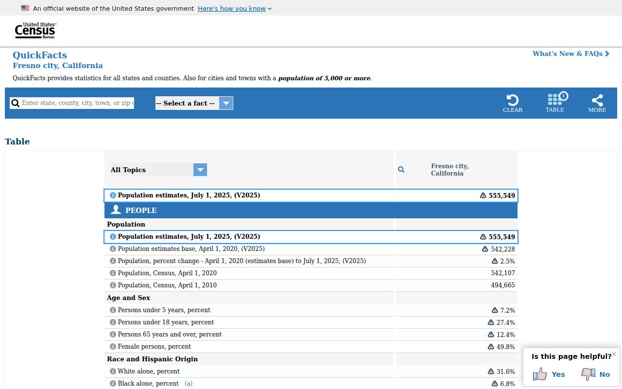
The Census image supplies city-scale context, not names. For a person or parcel question, return to the exact address, APN, and record custodian rather than using a ZIP-level estimate as identity evidence.
ZIP geography also intersects Fresno's agricultural and unincorporated edges. A mailing area may include rural routes, Fresno County islands, or newer growth beyond the historic Fresno city grid. Those places can require Fresno County planning, assessor, or Recorder records even when the postal city line says Fresno.
Fresno ZIP Area Notes
Broad area groupings can make a ZIP search easier to plan. Central Fresno and downtown work often begins with 93701, 93721, or 93728. South and southeast research may touch 93702, 93706, 93725, or 93727. North and northeast routes include 93704, 93710, 93711, 93720, 93730, and 93737. West and northwest work may involve 93705, 93722, or 93723, while 93703 and 93726 cover central or north-central sections.
These groupings are a research compass, not a boundary map. Tower District, Woodward Park, Sunnyside, Highway City, Fig Garden, and the downtown core have different development histories. The same neighborhood label can spill over a ZIP edge, and the same ZIP can include more than one community plan or jurisdiction.
When an old address is being traced, a modern ZIP should be recorded as a current delivery clue only. Historical directories, Sanborn maps, subdivision maps, and legal descriptions may use another Fresno city or rural label for the same physical area.
Fresno ZIP Research Workflow
A reliable ZIP code directory workflow keeps the handoffs visible: postal address to ZIP, ZIP to GIS, GIS to APN, APN to Assessor, and owner or legal description to Recorder. Each handoff answers a different question. USPS confirms mail routing. GIS confirms parcel and jurisdiction fields. The Fresno Assessor supplies value and roll clues. The Fresno Recorder preserves instruments. Elections, courts, libraries, and Fresno city departments must be chosen only after the record type is clear.
Keep a short research log with the exact address spelling, ZIP returned by USPS, APN, INSIDE_CITY value, ANNEX_DATE, date checked, and the portal used. If a result seems wrong, test the street suffix, direction, unit, city limit, and postal city before deciding that a person or parcel is absent. A changed ZIP or annexation can redirect the request to another custodian.
The ZIP geography is most useful as a narrowing tool. It does not replace a street search, a parcel record, a court party search, a vital-record request, or a lawful voter-file application. Keep the search at the smallest level supported by the source, and stop when the record cannot support a stronger claim.
Note: Fresno ZIP research is complete only after the postal result, parcel jurisdiction, and record custodian agree for the exact address.